WILDFIRES COLLECTIVELY AFFECT THE LOCAL REGION
Some with “good” effects and some causing “heartbreaking” impacts
CSERC strongly supports getting low-to-moderate-severity fire back into the forest ecosystem of the central region of the Sierra Nevada. The region’s forests evolved naturally with fire. When agencies do carefully managed prescribed burns or they allow well-managed low-intensity wildfires to burn, that can help consume built-up fuels and reduce the risk of future destructive, wind-blown conflagrations.
Currently (and mostly overlooked amidst all the media coverage of “out of control” wildfires), there are some good examples of very positive “managed wildfires” that are being allowed to continue to burn at this time within Yosemite National Park and the Stanislaus National Forest – causing mostly beneficial effects as they consume some of the countless dead trees and fallen logs that are left from the extreme multi-year drought and bark beetle infestations that killed millions of trees a few years back.
SOME EXAMPLES OF POSITIVE “MANAGED” FIRES IN THE YOSEMITE REGION:
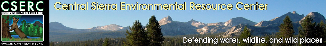
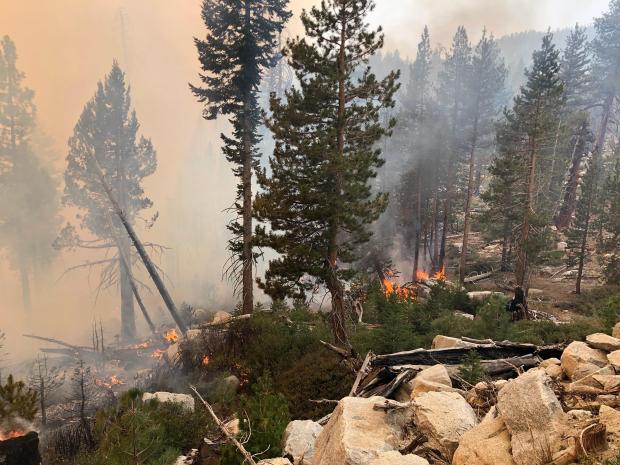
The fires listed below are burning mostly close to the ground, creeping along, without torching many trees or resulting in waves of flames racing across the landscape.
Blue Jay Fire (in Yosemite Park):
-
3,500 acres, 20% containment
-
4 miles south of White Wolf Camp
-
Ground litter burning, dead/down logs and isolated single tree torching, mostly in lodgepole and red fir stands amidst a lot of granite outcrops and ridges
-
Because the Blue Jay fire has bumped up along the Tioga Pass Road, it’s resulted in one-way traffic restrictions and occasional road closures
Blue Jay Fire
Wolf Fire:
-
828 acres, 50% contained
-
Ground litter burning, dead/down logs and isolated single tree torching, lodgepole and red fir
North Whizz Dome Fire
-
19 acres, just south of Cathedral Creek, 1 mile from Tioga Road
-
Managed through Minimum Impact Suppression Techniques (MIST)
-
Smoke production is really light
Horse Fire
-
23 acres, being monitored
-
Out near Wawona, north of the South Fork Merced: creeping along the ground
Bell Fire (in Stanislaus National Forest):
-
50 acres in size, being allowed to creep around within natural fire boundaries;
-
In the Emigrant Wilderness, the fire poses no risk to any community or high-risk value;
-
Burning in a large rocky area with sparse fuels, using MIST management practices, this a classic example of a slow-moving wildfire helping to clean up years of fuel build-up.
ADDING TO LOCAL FIRES, DISTANT FIRES SEND DENSE SMOKE
Fork Fire (in Eldorado National Forest):
-
1,752 acres, 7% containment
-
Main spread of this fire was driven by east wind gusts of 30-50 miles per hour - fire grew quickly to the west;
-
Burning mostly within the 2014 King Fire burn scar - heavy fuel loads due to dead and down trees, snags, and 4-6 foot-high post-fire regrowth of dense brush
North Complex Fires in Butte, Yuba, and Plumas Counties
-
269,358 acres, 32% containment
-
This assortment of individual fires (that have mostly burned together into a gigantic acreage of burned landscape) has resulted in a number of deaths of residents trapped in its path, as well as a large number of homes destroyed and popular recreation areas roasted by wind-blown flames.
-
Smoke from this Complex of fires has at times blown south across the Tahoe area and on south to blanket the Northern Yosemite region.
Creek Fire in the Sierra National Forest:
-
On September 15th this enormous wildfire was listed at 220,025 acres, 16% containment
-
The rapidly-expanding Creek Fire is now similar in size to the gigantic Rim Fire of 2013 that burned so intensely across vast areas of the Stanislaus Forest and Yosemite Park.
-
Highly popular recreation areas at Shaver Lake, Huntington Lake, and Mammoth Pool have all been affected.
-
Over 555 residences have already burned; 11,000 structures are at risk.
-
Prevailing winds have been driving the dense, thick smoke from the Creek Fire east and north across Yosemite Park and on north across the Stanislaus Forest and foothill areas.
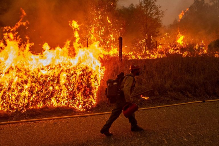
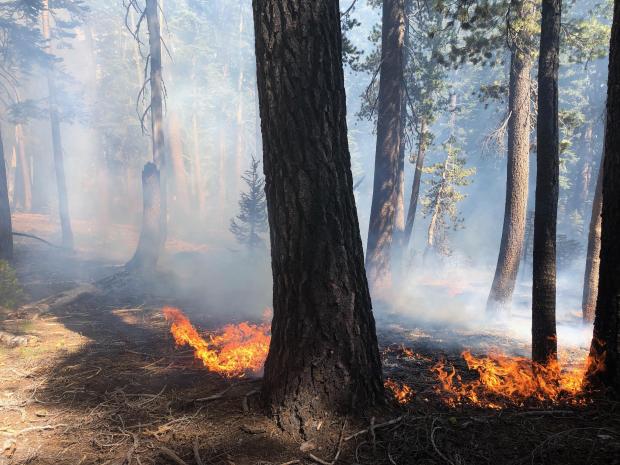
Springville Hotshots doing structure protection burn - (inciweb)
TOTAL ACCUMULATED SMOKE POSES HIGH HEALTH RISK
The information shared above highlights information about the fires that are cumulatively producing extremely dense smoke that has dramatically affected air quality across the Northern Yosemite region. Click on the link below to check out what all this concentrated smoke means for your health.