
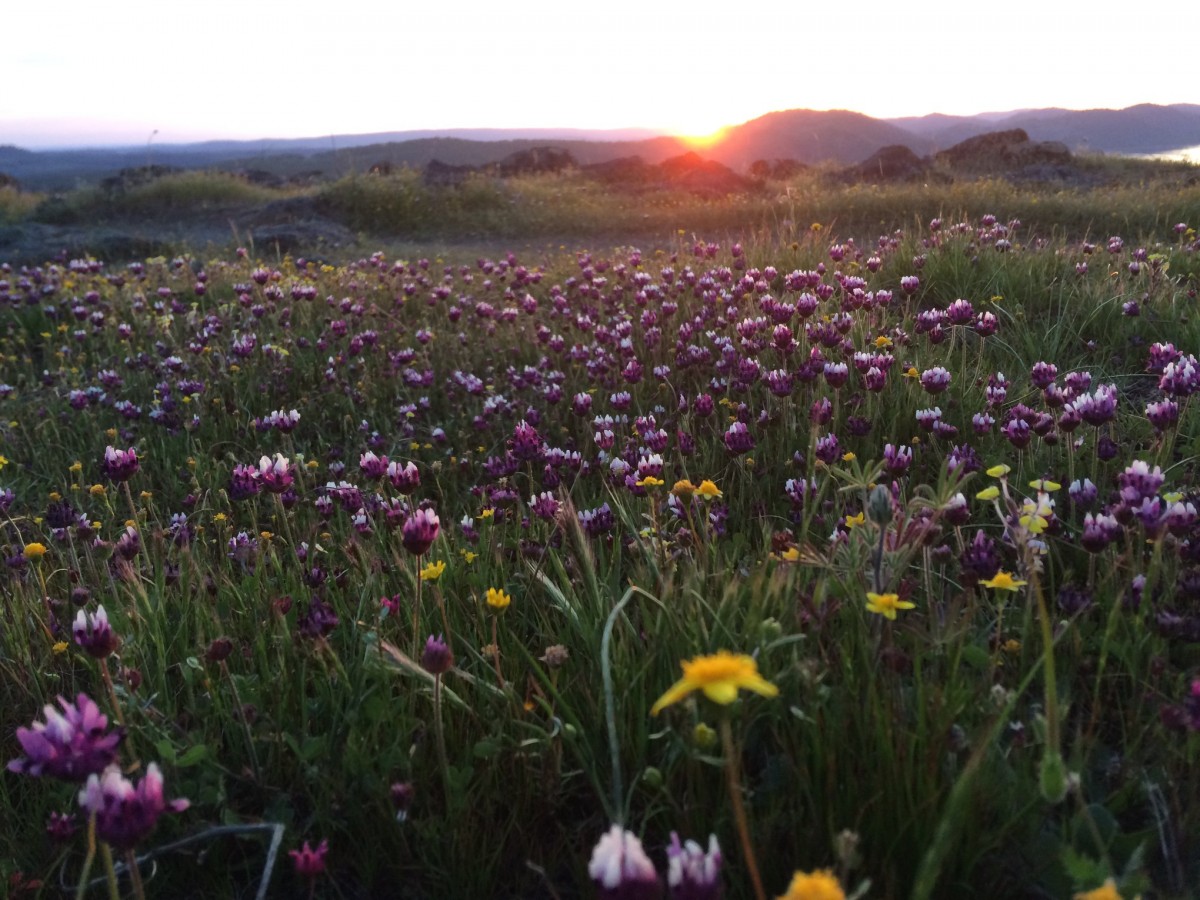
Spring has sprung, and the wildflowers are returning! Its that time of year when everyone is eager to get outdoors, and what better way to get out and enjoy nature than a wildflower hike. As a self-professed plant nerd this is inarguably one of my favorite times of the year. The following list of hikes are some of the best low elevation sites to see early wildflowers.
Table Mountain - The Table Mountain Trail, located between Jamestown and New Melones Lake, is a 2.7 mile one-way hike ranging from easy and flat at the beginning to rocky and steep near the top. Lupine, poppies and a host of others blanket the entire plateau of Table Mountain. Trailhead parking is at the end of Shell Rd. off of Rawhide Rd., where the road turns to dirt.
Heron Point Trail at New Melones Recreation Area: Right now this area is alive with poppies and a variety of other wildflowers, and is also great for bird watching. Off of Highway 49 take Reynolds Ferry Road and then turn right onto the short road leading to Heron Point Campground. The trail begins at the restroom and parking area.
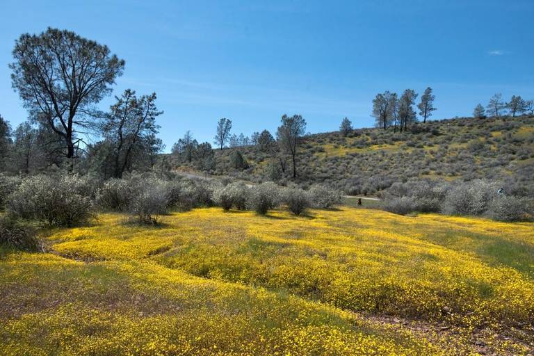
Red Hills Road Trail - Just south of Chinese Camp on Red Hills Road is a scenic route filled with California Goldfields, Blue Dicks and more. This area has special serpentine soils which support endemic species such as the Milkwort jewelflower found nowhere else. So if you’re into rare plants, Red Hills is a must see.
Natural Bridges – This trail off of Parrotts Ferry Road outside Vallecito is more than just a place to see a naturally formed rock bridge over Coyote Creek; it’s a wildflower wonderland, too. While walking down the trail to the bridge, guests pass several hillsides that have an abundance of spring flowers like poppies, goldfields and purple Chinese houses.
West Side Trail - This historic railroad grade near Tuolumne is lined with large bush lupines, buckwheats and more. It is a relatively flat hike with some markers indicating native plants. The parking area is located to the left off Buchanan Mine Rd. in Tuolumne before Sunrise Dr.
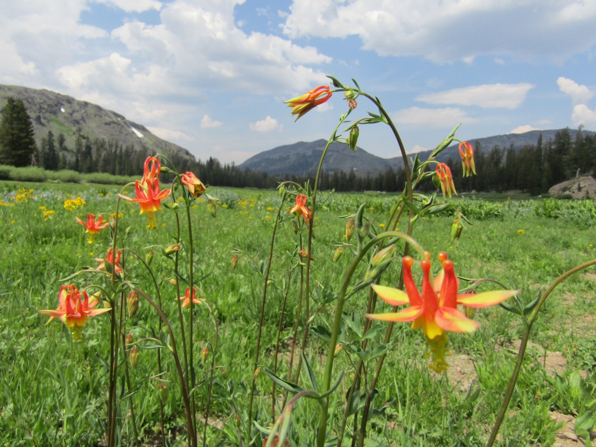
But the wildflower viewing is not just a springtime activity. Higher elevation areas in the Stanislaus National Forest put on a spectacular display in the summer. Check out the list below for places to visit this summer in June and July.
Bell Meadow - This beautiful meadow is at about 6500' but should still have nice wildflower blooms in June. A trail winds through the aspen groves, granite boulders, and old growth forests, crossing Bell Creek, a tributary to the Clavey. Take the Crabtree Road (4N26) off Highway 108 to 4N25, to 4N02Y.
Trail of the Gargoyles - This unique geological area is located about 6 miles after turning onto the Herring Loop Road (4N16). Great volcanic formations accompany wildflower displays of lupines, mule’s ears, Sierra onion, Leichtlin’s mariposa lily and spreading phlox, among others. It is a fairly easy hike but can be dangerous for young kids because of steep drop-offs from the trail.
Coyote Meadow to Cooper Meadow - Coyote Meadows to Cooper Meadow is a 3.75 mile one-way hike beginning at the Coyote Meadows Horse Camp passing through both Horse and Cow Meadows which boast a variety of wildflowers and some beautiful views. To get there take Highway 108 to 4N16 to 5N67 to reach the trailhead.
St. Mary's Pass - trailhead is on the north side of Highway 108 just before Sonora Pass. This high mountain trail has absolutely spectacular blooms in July and August. Be prepared for higher elevation hiking conditions and some good up and down terrain.