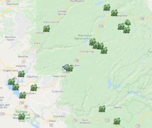
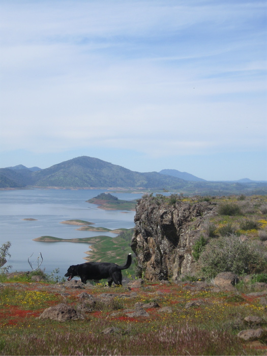
There are many beautiful destinations in the Central Sierra-Northern Yosemite region, and some of the best are off the beaten path. CSERC has created a list of more than 20 scenic destinations to get you started - from remote and quiet spots to destinations popular with local residents. We will continue to share additional destinations as we discover more.
Our recommended destinations are best enjoyed if you visit with the right gear and with valuable information about risks, options, and challenges. We encourage you to prepare carefully – bring the appropriate hiking equipment, water, maps, etc. before heading out to have a safe and enjoyable time.
We encourage anyone driving in the Stanislaus Forest to buy a copy of the Stanislaus Forest Road Map from any ranger district office. It can also be helpful to check with the district office regarding road conditions as they can change from year to year or due to weather effects.
 Find the beautiful places you want to visit

- Click on any of the places listed below for a drop down description of the destination.
- How to get there: Scroll down to our customized Google Map. Let us know if you have any questions about directions!
Scenic summer destinations
Summer is a wonderful time to explore some of the most scenic places in the Northern Yosemite and Central Sierra region. We have listed some of the most picturesque places below for you to discover and explore.
Preston Falls
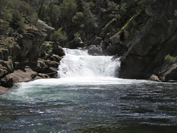 The Preston falls trailhead begins at an elevation of about 2,400 feet and is accessed from the Kirkwood Powerhouse off Cherry Creek Road, Forest Service Road 1N07. The trail is located in the Stanislaus National Forest and follows the main fork of the Wild and Scenic Tuolumne River for a moderate hike of 8.8 miles roundtrip with an elevation gain of 300 feet. There are many opportunities for swimming in the deep pools where the river is constricted between granitic blocks into a narrow gorge but beware the water is very cold since it comes from dam releases off of Hetch Hetchy reservoir, about 12 miles upstream. Wildflowers blanket the meadows as the trail meanders along the river through conifers and oaks. The final destination is Preston Falls, a lovely cascade emptying into an inviting large pool.
Carlon Falls
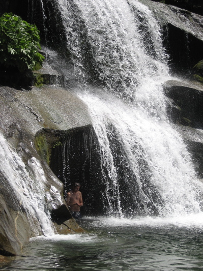 The Carlon Falls trailhead is accessed about a mile down Evergreen Road, off Highway 120 before the Big Oak Flat entrance gate to Yosemite National Park. While the trail begins in the Stanislaus National Forest, it soon enters the western boundary of the Park, following the South Fork of the Tuolumne River. This easy to moderate hike begins at an elevation of 4,320 feet and is 3 miles roundtrip with a 200 foot elevation gain. The trail is covered in shade most of the way and meanders through mixed coniferous forest and riparian woodlands.
Once you reach Carlon Falls, you’ll want to take plenty of time to relax, swim, and enjoy the views of the 45 foot high waterfall. For those that would like to explore farther, a short trail continues above the falls. That trail leads to more opportunities to wade and swim in smaller, but equally beautiful pools with polished boulders along the river. Remember, because this trail is located in the National Park, you’ll need to leave your dogs at home.
Bell Meadow
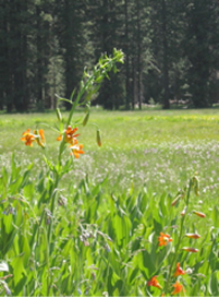 This large meadow is abundant with wildflowers in the early summer, and it can still have colorful displays into August. Bell Meadow also has one of the most beautiful aspen groves in the Stanislaus National Forest, which is especially spectacular in mid-autumn as the leaves change to yellow and gold. Not only is this meadow a beautiful place to enjoy just for itself, but it also serves as one of the easiest access portals into the Emigrant Wilderness. Extending out from the trailhead are miles of trail for you to enjoy. You can obtain a map of the Emigrant Wilderness before you visit (available from Sonora, Summit, or Groveland Ranger District offices) if you want to plan a day hike to one of the many alpine lakes that lie within the Wilderness.
Driving to the Bell Meadow trailhead takes about 40 minutes from Twain Harte (you take the Crabtree Road off of Highway 108), and the last half-mile of the road gets a little rough, but the road is drivable for most SUVs as long as you take it slow on the rough section.
Sword Lake/Lost Lake
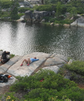 We selected these two spectacular lakes for those who enjoy a good day hike with a destination that has some of the best alpine lake swimming in the region. These neighboring lakes lie within the Carson Iceberg Wilderness. The trailhead is accessed off of a winding Forest Service dirt road that spurs off the Clark Fork paved route from Highway 108. The hike can be somewhat "busy" on a peak summer recreation weekend. You could run into as many as 15-20 people, but compare that to the hundreds you'd see any day of the week in Yosemite! The hiking terrain is moderate. It is a 6.4 mile round trip to Sword Lake with a 1,194 foot elevation gain. So expect to climb a few hills, but the trail is well maintained, and it should only take about 1.5 to 2 hours at most each way. Once you arrive at the lakes, you'll know the trip was worth the effort. The lakes are fairly long and deep, and you really get that backcountry feeling when you are there.
Drive time to the trailhead takes 70 - 80 minutes from Twain Harte. The last 20 minutes of driving on the dirt road will be pretty bumpy, but the road is wide open and navigable in any car. *NOTE: Much of the trail was burned in the 2018 Donnell Fire. Check with the Summit ranger station regarding access and safety.
Highland Lakes
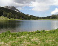 For those who want to access the outdoors from the Highway 4 corridor, we think that if you haven't been to Highland Lakes yet, it is time to visit. These high-elevation lakes can be accessed by any vehicle (even an RV). They have excellent rustic campgrounds, wildflowers blooming as late as September, good fishing (brook and rainbow trout), and miles of wilderness trails for a day hike or longer. The lakes and the land surrounding them are gorgeous for photography, picnics, or hillside scrambles. We highly recommend this area as a great spot to spend your day or weekend or as a starting point into an adventure in the Carson Iceberg Wilderness.
Drive time is just about 2 hours from Sonora and 1.5 hours from Murphys.
Pinecrest Lake
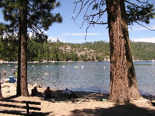
Pinecrest Lake is a beautiful and popular recreational destination. The lake is nestled within the forest amidst a picturesque mountain peak, but also has stores, bathrooms, and campgrounds available. Activities include:
Camping: There are two major campgrounds - Pinecrest Campground and Meadowview Campground.
Day Use Sites: There are day-use sites for picnicking, boat launching, and swimming at the Lake.
Interpretive Programs: The Forest Service offers interpretative programs throughout the summer.
Fishing: Fishing is allowed in the Lake with a fishing license. This can be purchased at the nearby Pinecrest commercial center.
Hiking: There is a trail that circumnavigates the entire Lake. By hiking to the far (east) side of the Lake and then heading upstream along the South Fork Stanislaus River, you can access the wild Waterhouse roadless area, Cleo's Bath (a scenic pool), and impressive vistas of the granite basin above the Lake. The Waterhouse roadless area is one of a number of wild, rugged areas that are not within the official wilderness.
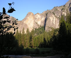
Yosemite National Park
Yosemite National Park is one of the most spectacular areas in the Sierra Nevada. Full of beautiful forests, rushing rivers, waterfalls, picturesque granite peaks, meadows, wildflowers, and so much more, it provides a great opportunity to experience nature up close. Some activities include:
 Camping: There are several campgrounds within the park including Lower Pines, North Pines, Upper Pines, and Tuolumne Meadows. Click for more information about reserving campsites. Reservations can be made 5 months in advance; if you hope to camp in the peak season, keep in mind that summer reservations are taken within the first few minutes of availability. Some (not all) campgrounds have first-come first-served campsites available as well.
Places to Visit: Some places to visit within the park include Yosemite Valley, Mariposa Grove of Giant Sequoias, Glacier Point, Hetch Hetchy, and Tuolumne Meadows.
Things to See:
- Waterfalls There are numerous waterfalls to visit within the park, including Yosemite Falls and Bridalveil Falls
- Rock Formations: Yosemite contains some amazing rock formations, such as El Capitan and Half Dome.
- Giant Sequoias: Some of the largest trees in the world, Giant Sequoias, also grow in the park.
- Vista Points: Popular vista points include Glacier Point, Olmsted Point, and the Tunnel View.
- Museums and Historic Buildings: Buildings to visit include the Yosemite Valley Visitor Center, the Nature Center at Happy Isles, and the Ahwahnee National Historic Lodge.
- Rivers and Lakes: Popular to see are Tenaya Lake, Mirror Lake, and Hetch Hetchy Reservoir. Rivers and seasonal creeks flow throughout the park.
- Swimming: Swimming is permitted in all areas of the park except at the Hetch Hetchy Reservoir and above waterfalls. One popular place for swimming is the Merced River within the Yosemite Valley. Remember to use caution any time flows are high or the water is cold.
Calaveras Big Trees State Park
Big Trees State Park contains many spectacular Giant Sequoia trees, the largest tree species in the world. Many have a height of 250 to 300 feet and a diameter as wide as 30 feet! Some activities within the park include:
Camping: There are two main campgrounds at the North Grove and Oak Hollow, 4 miles in from the main entrance. They also offer four environmental walk-in sites with fewer amenities.
Hiking: There are three main hiking trails within the park with great views of the “Big Trees” and interesting information on local plants and wildlife. These include the North Grove trail (1.5 miles), the South Grove trail (3.5 - 5 miles), and the Bradley Grove trail (2.5 miles).
Swimming: Swimming opportunities are available in the nearby Stanislaus River.
Interpretive Programs: Interpretative programs are often put on by park staff in the summer months to teach visitors about topics such as natural history and the environment.
Fishing: Fishing is also allowed within the Stanislaus River. A fishing license can be obtained within the park.
For more information, visit the State Park's website.
Spring and Fall destinations
During spring and fall, there are smaller crowds at popular destinations. The wildflowers in the spring and the turning leaves in the fall provide a truly colorful landscape to explore. Check out these trails in the shoulder seasons to take advantage of milder weather, fewer people, and a vivid landscape.
Dragoon Gulch - Sonora
 This hidden trail is nestled along Dragoon Gulch, tributary drainage of Woods Creek. The trail can be accessed from Woods Creek Rotary Park in Downtown Sonora, across from the fairgrounds on Stockton Road. The 60-acre property was dedicated to the City of Sonora. About 2 miles of trail that meanders through old-growth oaks, manzanita, toyon, and ponderosa pine has recently been developed. This is a year-round destination that is accessible to those who are looking for a quiet, easy walk close to town.
New Melones Reservoir
 As the snow piles up in the high country, winter rains turn the hills around our foothill lakes to a bright green. This is a great time to get out and enjoy the beauty of the foothill oak woodlands, particularly around New Melones, a premier destination for wildlife viewing. There are miles of trails for exploring by foot or mountain bike around New Melones Reservoir (Link here for tips on planning your visit and for trail maps). These trails are easily accessed via Glory Hole and Tuttletown Recreation areas off of Highway 49. For those who aim to do mountain biking, be sure to wait until the trails are dry to avoid rutting and erosion.
Wildlife viewing is one of the reasons why New Melones is a great low-elevation choice in the winter. Birds that have migrated down in elevation from the high mountains or from the north are in the oak woodlands and chaparral thickets along the trails. Eagles, ospreys, and waterfowl can be seen along the reservoir shore and inlets.
Table Mountain
 This approximately 2.5 mile loop trail is an excellent early spring wildflower day hike that is easy to access and provides an amazing vista if you make the steep climb to the top of Table Mountain. This hike is highly recommended, but beware of poison oak - also prepare for very hot weather if you go in the summertime.
You can park at the first gate and access the trail for a nice wander through oak woodlands. In dry weather (and with a high clearance vehicle), you can drive through two more gates and park by the vaulted toilets, and meet up with the trail here for a much shorter hike. You can also access New Melones Reservoir easily from this second parking area, so consider bringing your fishing pole.
To view a trail map of the Table Mountain trail and other local recreation trail maps on Bureau of Reclamation land, click here.
Red Hills Area of Critical Environmental Concern
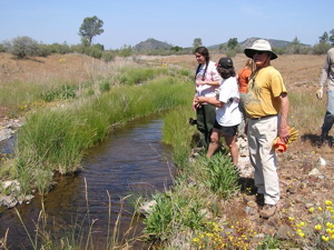 This unique area lies well below the snow line off of Highway 49, right outside of Chinese Camp. Known for the diverse range of unique species of plants and animals found here due to the serpentine mineral content in the soil, the Bureau of Land Management (BLM) has over 17 miles of hiking/biking trails available for the public to enjoy. If you are observant, you might be lucky enough to spot a Roadrunner! Consider visiting in the springtime, too, as the wildflower season in the Red Hills is impressive.
Learn more about the Red Hills here
Natural Bridges
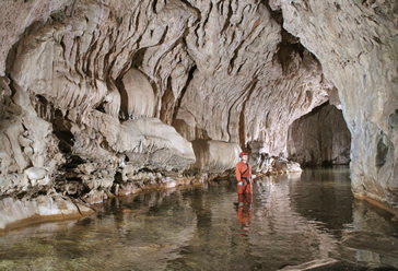 Between Columbia and Murphys off of Parrots Ferry Road, this year-round easy-access trail leads down to a picnic site/swimming hole. The 1.5 mile trail takes you down to Coyote Creek, where some amazing swim holes allow you to swim through limestone caverns under natural land bridges! There is poison oak along the trail, so know what it looks like and avoid it at all times.
Please remember that unique geologic structures such as this take thousands of years to form, and be especially respectful of the landscape when visiting. To view a trail map, click here.
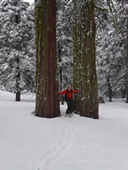
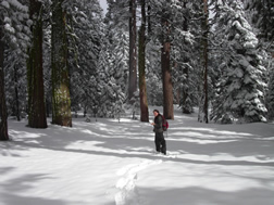
Places to explore in the snow
If you are seeking a winter wonderland adventure, visit one of these scenic destinations to ski or snowshoe. Don’t let the cold and short days keep you from experiencing the beauty of the snowy northern Yosemite region in the winter.
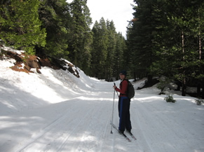
Cross-country Ski Near Pinecrest
 There are several trails and roads designated for cross-country skiing around Dodge Ridge. Skiing on Crabtree Road from its intersection with Dodge Ridge Road takes you on a 2.5-mile incline up to Aspen Meadow. Trails for more skilled and adventurous backcountry skiers can be taken off of Crabtree Road leading to steeper slopes and views of the North Fork and Clavey River drainages.
The Gooseberry Road trail offers moderate to advanced opportunities for cross-country skiing and snowshoeing with varying terrain just beyond the Dodge Ridge parking area on the loop road. For those just wanting a beginning opportunity, a short snowshoe or ski excursion up into the forest is easy at this location. Cross-country ski trail maps for the Dodge Ridge area are available at the Forest Service Summit Ranger Station and the Dodge Ridge ski center. The maps provide more detailed information as to the skill level required for various routes.
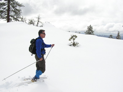
Cross-country Skiing On Herring Creek Road
 This Forest Service road is located just two miles east of Strawberry off Highway 108 and receives far fewer visitors than the Dodge Ridge area. Its gradual incline is ideal for moderate-level cross-country skiing. For those wanting to head out a few miles with a destination in mind and a map in hand, you can ski out to the Herring Creek bridge and old-growth forest groves on the south side.
Cross-country Ski or Snowshoe Sugar Pine Railroad Grade by Lyons Reservoir
In most winters there is enough snow for cross-country skiing and snowshoeing at lower elevation destinations. The Lyons Reservoir Road is located just west of Long Barn on Highway 108 past Sierra Village. There is a large pullout for parking on the north side of the road. The road eventually leads to Lyons Reservoir, which is about a 2-mile trek downhill from the highway.
Calaveras Big Trees State Park
Along the Highway 4 corridor, Calaveras Big Trees State Park offers exceptional beauty and a chance to see wildlife in a moderate elevation park setting. Parking at the main lot and taking the “closed for the winter” main road out into the Park is the easiest way to explore on either cross-country skis or snowshoes. The west-side entrance to the Park can also be a good option for those who prefer fewer people and a steeper incline.
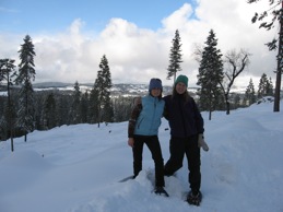
Bear Valley Offers a Host of Options
The Bear Valley area is one of the most spectacular scenic destinations in the region for winter recreation. Bear Valley Cross Country as well as Mountain Adventures Seminars are two local businesses that provide a range of exciting skiing, snowboard, and snowshoe adventures with excellent guides, trails, etc.
For those only wanting a short outing, the Spicer Road area has a snow park and plenty of areas for snow play, skiing, or snowshoes. Go online to learn about the Snow-Park regulations if you plan to use that facility.